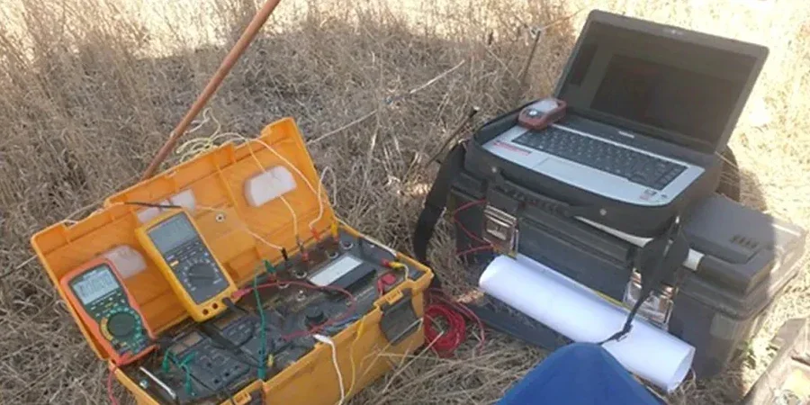
Too many London consultants still rely on boreholes alone and miss lateral variations in the clay-rich till that runs across the city. A single SPT log tells you what is at one point. Electrical resistivity, run as a Vertical Electrical Sounding array, maps the transition from saturated silty clay into limestone bedrock continuously. Along the Thames River floodplain and in the Hyde Park commercial corridor, ignoring resistivity data has led to unexpected excavation depths and cost overruns. We pair VES surveys with a CPT test when near-surface fill is suspect, and a MASW survey to tie shear-wave velocity to the same transect. Our field crew runs a 4-electrode Schlumberger array, collecting apparent resistivity values at expanding spacing to model true resistivity versus depth, all referenced to the NBCC 2020 and ASTM D6431-18 guidelines.
Electrical resistivity in London cuts through the ambiguity of a single borehole by showing you the continuous profile between control points.
Our approach and scope
Site-specific factors
Under the Ontario Building Code (NBCC 2020 Part 4), site investigation must characterize subsurface conditions across the entire footprint, not just at discrete borehole locations. In London, where the interface between the Port Stanley Till and the underlying Dundee limestone can vary by several metres over short distances, a VES line fills the gap. Missing a shallow bedrock high beneath a proposed footing or a saturated silt pocket in a slope stability analysis creates a liability that no geotechnical report can excuse. The resistivity contrast between dry granular fill and saturated native clay is often the only early warning of a perched water table that will complicate excavation dewatering. We deliver inverted resistivity sections within 48 hours so the design team can adjust foundation levels or shoring depths before tendering.
Applicable standards
NBCC 2020 Part 4 (National Building Code of Canada), ASTM D6431-18 (Standard Guide for Using the Direct Current Resistivity Method), CSA A23.3 (Design of Concrete Structures, referenced where resistivity informs corrosion risk)
Other technical services
Depth-to-Bedrock Profiling
Mapping limestone surface beneath till across commercial lots in south London and the 401 corridor.
Landfill & Contaminant Plume Delineation
Lateral extent of leachate in sandy aquifers, using resistivity lows to track conductive plumes.
Groundwater Table Mapping
Identifying perched water within the upper weathered till zone for dewatering design.
Pipeline & Utility Corridor Surveys
Continuous resistivity profiles along proposed trench alignments to avoid unexpected rock ripping.
Typical parameters
Quick answers
What is the typical cost for a VES survey in London Ontario?
For a single Vertical Electrical Sounding point with a field report and 1D inversion model, budget between CA$920 and CA$1,310. A full-day program with multiple soundings or a 2D resistivity line will scale from there, depending on electrode spacing and line length.
How deep can electrical resistivity testing see in London soils?
With a Schlumberger array and a maximum current-electrode spacing of 100 metres, we routinely reach 30 to 45 metres below grade. The actual penetration depends on the resistivity contrast: the conductive Port Stanley Till attenuates signal faster than dry sand, but the strong contrast with limestone bedrock gives a clear target.
How long does a VES survey take on site?
A single sounding point takes roughly 2 to 3 hours, including stake layout, contact resistance checks, and data stacking. A multi-point line across a half-hectare commercial lot in London is typically completed in one working day.
Can VES replace boreholes for a geotechnical investigation?
No. VES provides continuous stratigraphic information but does not recover soil samples for laboratory testing. The best practice in London is to calibrate resistivity profiles with at least one borehole or CPT sounding so that resistivity values are tied directly to known soil units.